The Garmin eTrex series are popular handheld GPS units. The eTrex H is a inexpensive unit with excellent sensitivity and accuracy, and the eTrex Vista HCx is a favorite of OpenStreetMap contributors because it accepts a microSD card which can hold OSM maps. I intended to use my Vista HCx to contribute to OSM and to georeference photographs, but I was shocked to discover that eTrex units remove time information from saved tracks. This means that saved tracks aren’t useful if you want to georeference photographs with an application like GPicSync. There’s a simple solution to this problem: avoid using saved tracks, and download the “Active Track” instead.
Saved Tracks
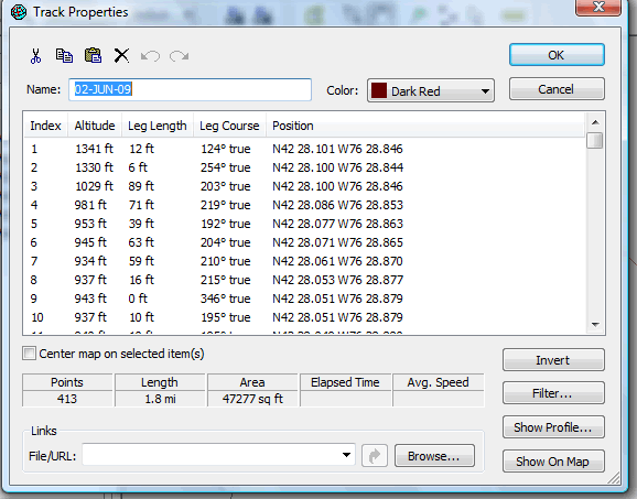
The eTrex units “dumb down” saved tracks by (i) reducing the number of points, (ii) removing time information, and (iii) applying spatial filtering. A saved track looks like this in Garmin MapSource:

This track could be useful for mapping, but lacking time information, it can’t be used to reference events that occur at a particular moment in time. Although the eTrex has a number of menu items for configuring the active track (to, for instance, increase the sample rate at which points are taken) there are no options that influence the information stored in saved tracks.
What’s in your eTrex?
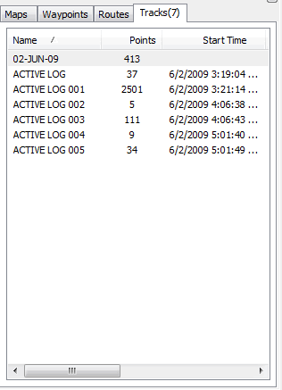
Once you’ve loaded tracks from your eTrex, you’ll see that there are both saved tracks and a collection of “active logs”:

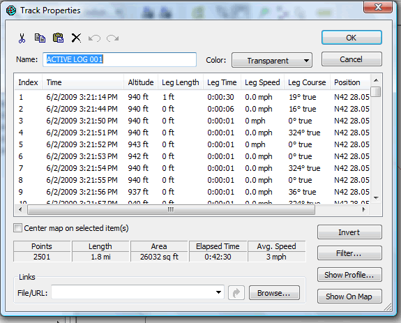
You’ll usually find more than one active log: new ones are created in order when the unit is power cycled or the track is otherwise reset. Active logs respect the sampling rate you’ve specified, keep timestamps, and are less filtered than saved tracks:

Conclusion
Avoid saved tracks if timestamps matter to you. You’ll lose the advantage of using saved tracks to organize your tracks, but this should matter little if you’re georeferencing photographs: GPicSync looks at all of the tracks in the .gpx file and uses timestamps to match everything up.
]]>